ccplot is an open source command-line program for plotting profile, layer and earth view data sets from CloudSat, CALIPSO and Aqua MODIS products.
Features
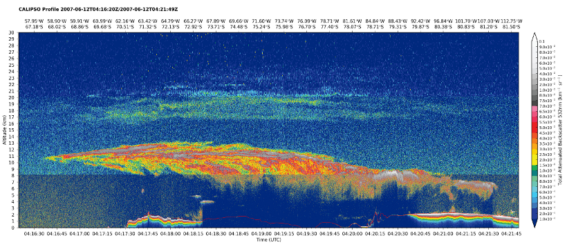
CALIPSO profile and layer plots
Including surface elevation, custom colormaps and easy extent selection.
ccplot -o calipso532.png -c calipso-backscatter.cmap -a 30
-x 4:16:20..4:21:50 -y 0..30000 calipso532
CAL_LID_L1-ValStage1-V3-01.2007-06-12T03-42-18ZN.hdf

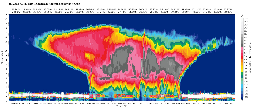
CloudSat profile plots
ccplot -c cloudsat-reflectivity.cmap -a 15 -x 24.60S..31S,50W..60W
-y -1000..18000 cloudsat-reflec
2009037050924_14779_CS_2B-GEOPROF_GRANULE_P_R04_E02.hdf

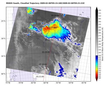
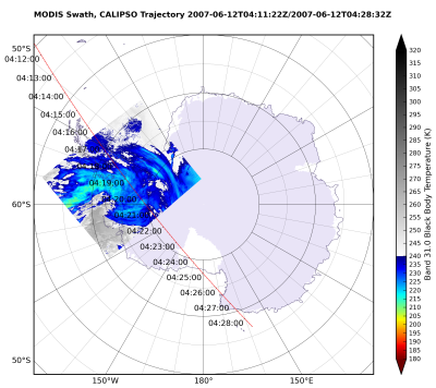
CloudSat and CALIPSO trajectories on top of MODIS swath
Several projections and MODIS bands are supported.
ccplot -o orbit-modis_x31+cloudsat.png -m x31 -c modis-temperature.cmap
-p tmerc orbit-clipped
MYD021KM.A2009037.0515.005.2009332033315.hdf
2009037050924_14779_CS_2B-GEOPROF_GRANULE_P_R04_E02.hdf
ccplot -o orbit-modis_x31+calipso_spstere.png -m x31 -c modis-temperature.cmap -p spstere:boundinglat=60S orbit-clipped
MYD021KM.A2007163.0415.005.2009290181256.hdf
CAL_LID_L1-ValStage1-V3-01.2007-06-12T03-42-18ZN.hdf

